Reading a topographic map without GPS comes down to three skills: understanding contour lines, taking and following a bearing, and navigating by handrails like ridges, streams, and trails. Learn all three on one simple practice route, and you can find your way anywhere a paper map covers, even with a dead phone battery.
This guide teaches each skill through a single worked example. You will practice at the kitchen table first, then carry the same method onto a trail you already know. That way, if you ever need the skill in fog or on an unmarked junction, it is already familiar.
There is a reason the old skill still matters. Dictionaries define reading as interpreting signs of any kind, not just print — Dictionary.com includes reading a cloudy sky as a threat of storm, or reading a stream for pools, among its meanings of the word. A topographic map is the same kind of sign system: a compressed picture of the ground, waiting to be interpreted.
What do contour lines actually tell you?
Contour lines connect points of equal elevation. Where lines sit far apart, the ground is gentle. Where they crowd together, the slope is steep. That single rule does most of the work of map reading.
Learn the shapes and the rest follows. A closed circle of contours is a hilltop or summit. A hourglass pinch between two sets of circles is a saddle, the low point between two highs. Lines that form a V or a U crossing a slope point uphill toward higher ground, and when they cross a drainage, the V points upstream, toward the head of the valley. Ridgelines and valleys run parallel to their contours, so tracing one line with your finger usually traces the landform itself.
Check the map's contour interval, printed in the legend. It tells you how much elevation change each line represents. You do not need to memorize any standard value: read the interval off the map you are holding, because it varies between map series. What matters is relative spacing on your own sheet.
How do you orient a map to the landscape?
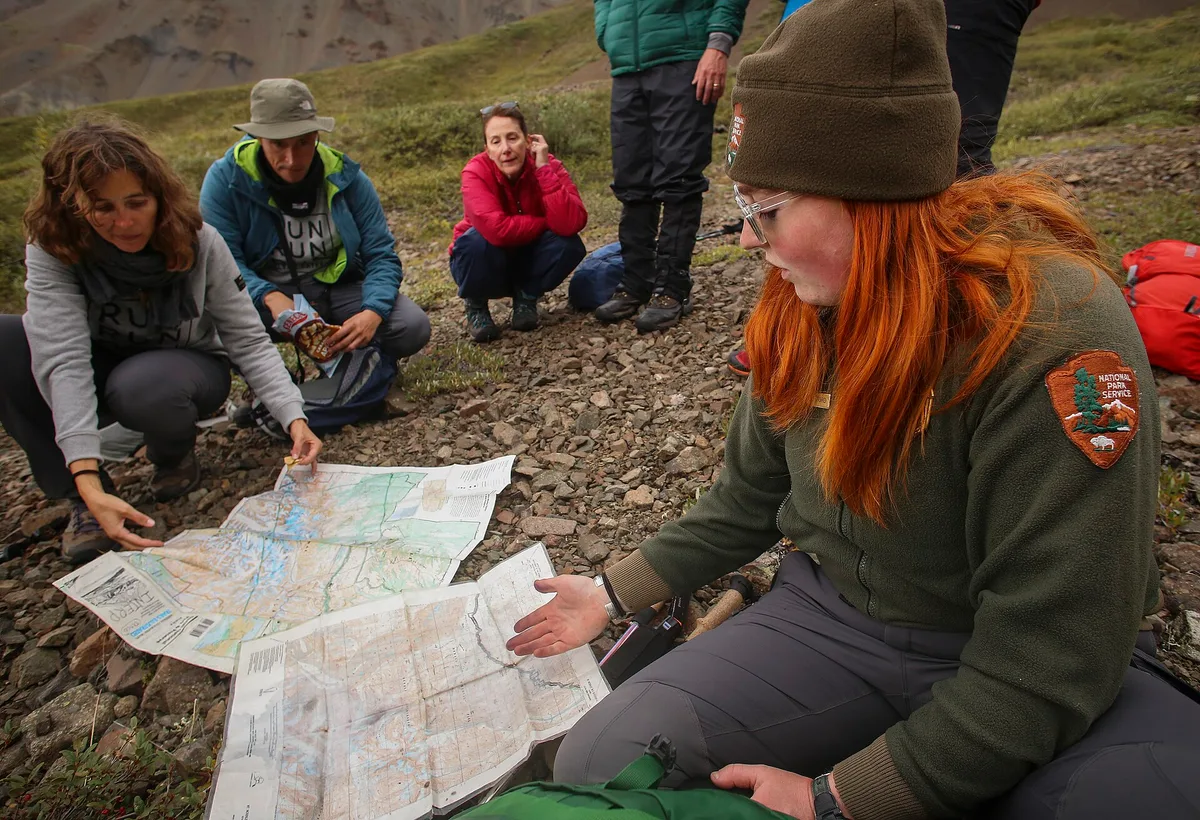
Orienting means rotating the map so it matches the world in front of you. Set your compass on the map, turn the whole map until its north lines align with the compass needle, and the features on the paper now sit in the same directions as the features around you.
Once the map is oriented, do a reality check. Match one or two obvious features — a lake corner, a spur ridge, a trail bend — to what you can see. If they line up, you know where you are. If nothing matches, stop moving and sort it out before you go farther. Walking on to "find something recognizable" is how people get properly lost.
One caution worth stating plainly: compass north, grid north, and true north are not always identical, and the difference is called declination. Maps print the local value in the legend. Adjusting for it matters most when you take precise bearings over long distances; for casual map orientation, aligning with the north lines is enough to start.
How do you take and follow a bearing?
A bearing is simply a direction expressed in degrees, from north through east, south, and west. You use it to walk a straight line toward something you cannot yet see.
- From map to ground: lay the compass edge between where you are and where you want to go, with the direction-of-travel arrow pointing at your goal. Turn the compass housing until its orienting lines parallel the map's north lines. Hold the compass level, turn your body until the needle sits in the housing's outline, and walk toward the direction-of-travel arrow.
- From ground to map: point the direction-of-travel arrow at a landmark you can see, rotate the housing until the needle is boxed, then set the compass on the map with its edge on your position. The line it draws identifies the landmark and your own location.
In practice you rarely walk a bearing by staring at the needle the whole way. Pick a tree or rock along your bearing line, reach it, then sight the next one. In fog or dense timber, leapfrog a partner the same way.
What is handrail navigation, and why does it work?
A handrail is a linear feature you can follow without constant measuring: a stream, a ridge crest, a shoreline, a powerline cut, the edge of a meadow. Like a stair handrail, it keeps you on course while you attend to other things. You navigate parallel to it, checking your pace and direction occasionally rather than continuously.
Handrails pair with two other tricks. An aiming off tactic deliberately biases your bearing to one side of a target lying on a handrail, so when you reach the rail you know with certainty which way to turn. A backstop is a feature beyond your target — a trail crossing, a lake edge — that tells you plainly you have gone too far.
Our analysis: one worked example, start to finish
Here is the whole method applied to a hypothetical practice route. Invent one for your own area on a current map; the numbers below are illustrative, not a real trail.
Picture a route that starts at a road trailhead, climbs a ridge to a small summit, drops through a saddle, and descends a stream valley to a lake. On the map it looks like this: two contour circles at the summit, a tight pinch of lines at the saddle, and a single blue line meandering down to the lake shore.
- Orient first. At the trailhead, align the map's north lines with your compass. Confirm the road and the first ridge match the paper.
- Read the climb. The contour spacing on the ridge flank tells you where the grade eases. Aim for the spur where lines widen, not the steepest face where they bunch.
- Take a bearing to the summit. Compass edge from your position to the closed circle, rotate the housing, walk the line, using trees as intermediate targets.
- Use the saddle as a handrail-to-be. From the summit, the V shapes draining away on both sides confirm the low point between the highs. Aim slightly off to one side of it, so when you arrive you know which way the stream lies.
- Follow the stream. The watercourse is your handrail. Keep it in view or within earshot, and let the lake shore be your backstop: if the ground opens to water, you have arrived. If you cross a second stream instead, that is a catching feature telling you to stop and reassess.
Run this drill on any familiar trail and you will feel the map turn from a picture into a model. Practice it a few times close to home, then bring it on bigger trips. It pairs well with a packed kit — see our guide to What to Pack in a Hiking Day Pack: The Ten Essentials, Sorted by Trip Length for what belongs beside the map. For related coverage, see What to Pack in a Hiking Day Pack: The Ten Essentials, Sorted by Trip Length.
What should you do before you rely on paper alone?
Buy the current map for your area from the managing agency or a reputable map publisher, and check its print date. Trails reroute, roads close, and an old sheet can lie to you. Learn the legend: contour interval, scale, and the symbols for water, vegetation, and man-made features all differ between series.
Practice in easy conditions deliberately. Pick a short loop you know, leave the phone in the pack, and navigate it on paper. Then repeat it in worse visibility, when the skill actually earns its keep. If you are building toward longer independent trips, our guide on How to Plan Your First Solo Hike Without the Anxiety covers the wider planning picture, and the Outdoors section collects more route and skills coverage.
Carry the compass even when you carry the phone. Electronics fail in cold, wet, and canyons; a map in a plastic sleeve and a baseplate compass weigh almost nothing and never run out of battery.
Where does this leave you?
Contour lines tell you the shape of the ground. Bearings turn a map direction into a walking direction. Handrails, aiming off, and backstops let you hold a course with less effort and catch your mistakes early. Master all three on one worked example, and the map stops being a fallback and becomes the tool you reach for first. Conditions and map editions change — check with the managing agency for current maps and route status before you go.